Learn to photograph Northern Lights like a pro. Sign up for Peter Rosen's Aurora Photo Courses in Abisko National Park. | | |
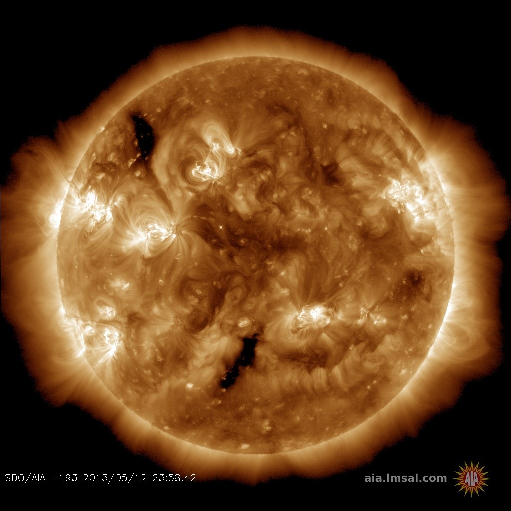
QUIET SUN: Solar activity is low. With no sunspots actively flaring, the sun's X-ray output has flatlined. NOAA forecasters estimate a scant 1% chance of X-flares and a 25% chance of M-flares on Feb. 13th. Solar flare alerts: text, voice
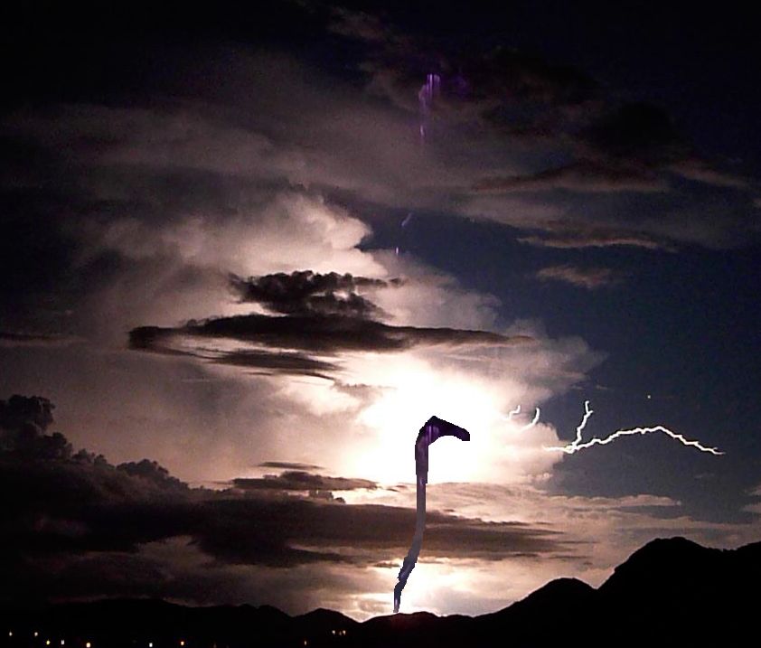
SUMMER SPRITE AND VENUS: Summer is the season for sprites, a form of lightning that leaps up from the tops of thunderstorms. Yesterday at sunset in Mutare, Zimbabwe, south of the equator, the summer heat was just beginning to break when Dr Peter Lowenstein photographed a purple sprite leaping out of the storm clouds:
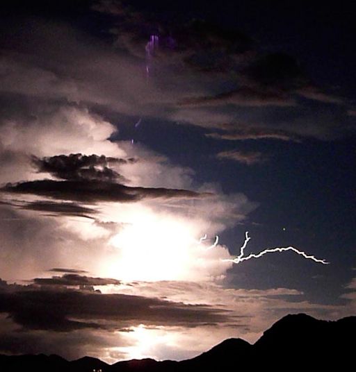
"I took the picture from the verandah of my house," says Lowenstein. "A late afternoon cumulonimbus cloud has developed into a small evening thunderstorm with frequent flashes of lightning. The photograph shows a cloud-to-ground strike with side flash just below Venus. There is also what looks like a sprite rising vertically upwards."
Sprites are a true space weather phenomenon. They inhabit the upper reaches of Earth's atmosphere alongside noctilucent clouds, meteors and auroras. Some researchers believe they are linked to cosmic rays: subatomic particles from deep space striking the top of Earth's atmosphere produce secondary electrons. When those electrons penetrate thunderclouds, they could provide the spark that triggers sprites.
Although sprites have been seen for at least a century, most scientists did not believe they existed until after 1989 when sprites were photographed by cameras onboard the space shuttle. Now summertime "sprite chasers" regularly photograph the upward bolts from their own homes. Give it a try!
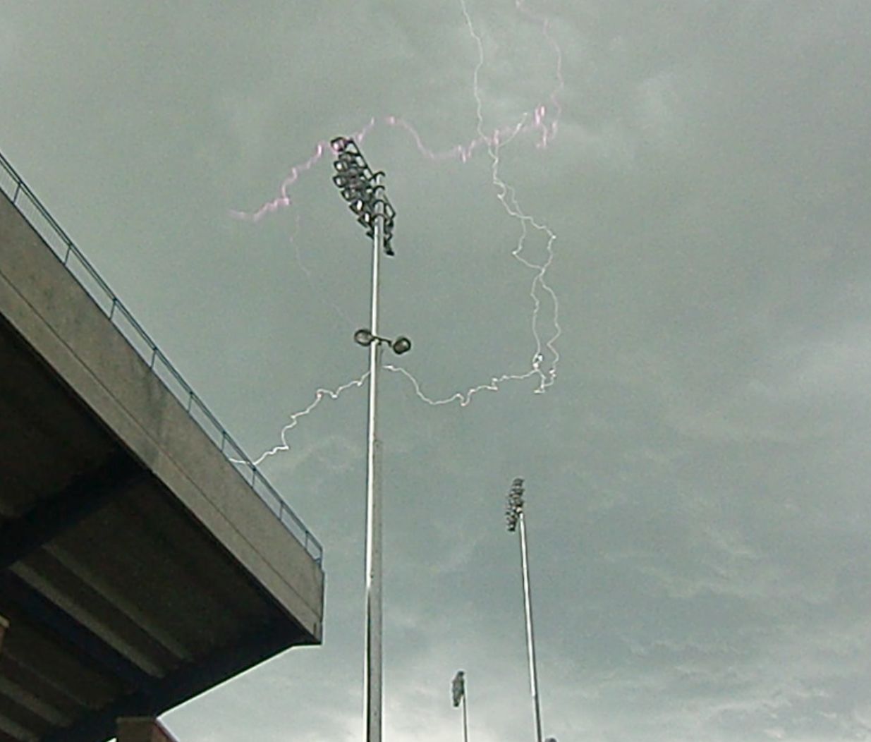
SPRITE UPDATE--IS IT REAL? Jared Rice, a PhD student in astrophysics at the UNLV Department of Physics and Astronomy has doubts about the sprite in Dr. Lowenstein's photo. "It might be an internal reflection in the camera," he suggests. "I have taken a similar image of a lightning storm on the campus of Montana State University during the day of the Venus transit June 5, 2012. My image shows a bolt of lightning with a purple reflection just above it. It exhibits a similar color and 'blurriness' as the candidate sprite. It is my opinion that Dr. Lowenstein has captured a similar phenomenon." To support his argument, Rice created a Photoshopped image in which he cut out the sprite and placed it beside the main lightning bolt."It 'fits' nicely, with the clouds blocking the bolt as they should." If Rice's analysis is correct, it highlights the possibility of 'false sprites' caused by reflections of regular lightning.
Realtime Sprite Photo Gallery
DEEP SPACE CLIMATE OBSERVATORY: For years, space weather forecasters have worried about the aging ACE spacecraft, which provides early warnings of CMEs and other solar storms bearing down on Earth. Launched in 1997, ACE could fail at any moment, leaving us blind to incoming storms. On Feb. 11th, NOAA, NASA and the US Air Force launched a replacement--the Deep Space Climate Observatory (DSCOVR).
DSCOVR blasted off from Cape Canaveral on Wednesday at 6:03 p.m. EST atop a SpaceX Falcon 9 rocket. Shortly after liftoff, an American Airlines flight en route from JFK to San Juan flew past the area. Passenger Tim Leavitt pointed his iPhone out the window and captured some remarkable shots of the rocket's exhaust:
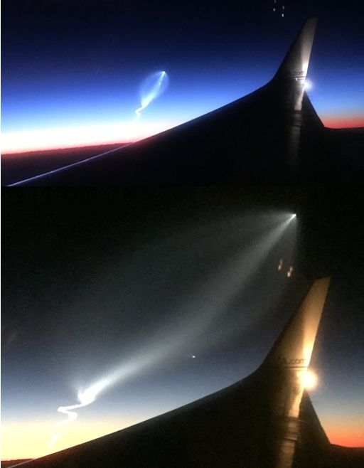
"What an amazing vantage point--and a lucky shot," says Leavitt.
The spacecraft is now on its way to the L1 point where it will monitor the solar wind one million miles upstream from Earth. NOAA says DSCOVR is in good health. Its solar arrays have deployed and it is communicating with the ground. Approximately 150 days after launch, DSCOVR will replace ACE as our primary warning system for solar magnetic storms.
In addition to monitoring the solar wind, DSCOVR will also look back at Earth. The spacecraft's EPIC camera has ten filters for photographing our planet at wavelengths ranging from UV to visible light. True-color images of the full sun-facing side of Earth will be publicly available approximately 24 hours after they are taken. The first images will be posted approximately six months after launch. EPIC's observations will be used to measure ozone and aerosols, cloud height, vegetation properties and the ultraviolet reflectivity of Earth. Another instrument onboard, called NISTAR, measures solar energy reflected from the sunlit face of Earth. This will help climate scientists track changes in Earth's radiation budget caused by human activities and natural phenomena.
Got pictures of the launch? Submit them here.
Realtime Space Weather Photo Gallery
Realtime Comet Photo Gallery
Realtime Aurora Photo Gallery
Every night, a network of NASA all-sky cameras scans the skies above the United States for meteoritic fireballs. Automated software maintained by NASA's Meteoroid Environment Office calculates their orbits, velocity, penetration depth in Earth's atmosphere and many other characteristics. Daily results are presented here on Spaceweather.com.
On Feb. 13, 2015, the network reported 16 fireballs.
(16 sporadics)
In this diagram of the inner solar system, all of the fireball orbits intersect at a single point--Earth. The orbits are color-coded by velocity, from slow (red) to fast (blue). [Larger image] [movies]
Potentially Hazardous Asteroids (
PHAs) are space rocks larger than approximately 100m that can come closer to Earth than 0.05 AU. None of the known PHAs is on a collision course with our planet, although astronomers are finding
new ones all the time.
On February 13, 2015 there were potentially hazardous asteroids.
Notes: LD means "Lunar Distance." 1 LD = 384,401 km, the distance between Earth and the Moon. 1 LD also equals 0.00256 AU. MAG is the visual magnitude of the asteroid on the date of closest approach. | | The official U.S. government space weather bureau |
| | The first place to look for information about sundogs, pillars, rainbows and related phenomena. |
| | Researchers call it a "Hubble for the sun." SDO is the most advanced solar observatory ever. |
| | 3D views of the sun from NASA's Solar and Terrestrial Relations Observatory |
| | Realtime and archival images of the Sun from SOHO. |
| | from the NOAA Space Environment Center |
| | the underlying science of space weather |


